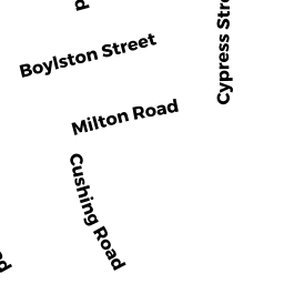
10 EAST MILTON RD
Owner Information
MOTSIS JOHN C
10 E MILTON RD #2
BROOKLINE, MA 02445


Property Details
10 EAST MILTON RD is classified as a Three-Family Residential (Decker).
The primary structure on this property was built in 1900. There is 5,147ft2 of residential/living space within this property. This property is listed as having 18 rooms. There are 3 units within this property.
10 EAST MILTON RD is valued at $1,870,500. The land is valued at $676,500 and the structures are valued at $1,194,000.
This property is in Zone M10. Confirm with local Zoning Board authorities to ensure there are no overlays or other easements on this property.
The most recent deed for 10 EAST MILTON RD is recorded at the local registrar in Book 24880, Page 438. 10 EAST MILTON RD was last sold on Friday, June 8, 2007 for $1.
Assessment data from fiscal year 2021.
Flood Data
According to the FEMA National Flood Hazard Layer, this property does not appear to be in a flood zone. It may also be in an area not yet reviewed. Nonetheless, confirm this information prior to taking any action.
To view the flood hazards around this property, create a FEMA "Firmette" Map of the area around 10 EAST MILTON RD.
Broadband Internet Providers
| Provider | Type | Bandwidth (mbps) | |
|---|---|---|---|
| Starry, Inc. | Fixed Wireless | 200 | 200 |
| RCN | Cable | 1000 | 20 |
| RCN | Cable | 500 | 20 |
| Comcast | Cable | 1000 | 35 |
| Verizon New England Inc. | DSL | 15 | 1 |
| Viasat Inc | Satellite | 100 | 3 |
| MCI | Copper Wire | 0 | 0 |
| VSAT Systems, LLC. | Satellite | 2 | 1 |
| HughesNet | Satellite | 25 | 3 |
| GCI Communication Corp. | Satellite | 0 | 0 |
| netBlazr Inc | Fixed Wireless | 500 | 500 |
Broadband service provider data from December 2020.
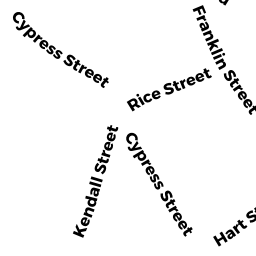
Adjacent Properties
- 150 CYPRESS ST
Three-Family Residential owned by FLESSAS THEODORE W - 144 146 CYPRESS ST
Mixed Use (Primarily Residential, some Commercial) owned by 144 CYPRESS LLC - 14 EAST MILTON RD
Three-Family Residential owned by ARAUJO PAUL - 308 316 BOYLSTON ST
Automotive Vehicles Sales and Service owned by ONEILL, TR GERARD T